
Contact for the resource
European Topic Centre - University of Malaga
171 record(s)
Type of resources
Available actions
Topics
Keywords
Contact for the resource
Provided by
Years
Formats
Representation types
Update frequencies
Status
Service types
Scale
Resolution
panaceaKeywords
GEMET keywords
-
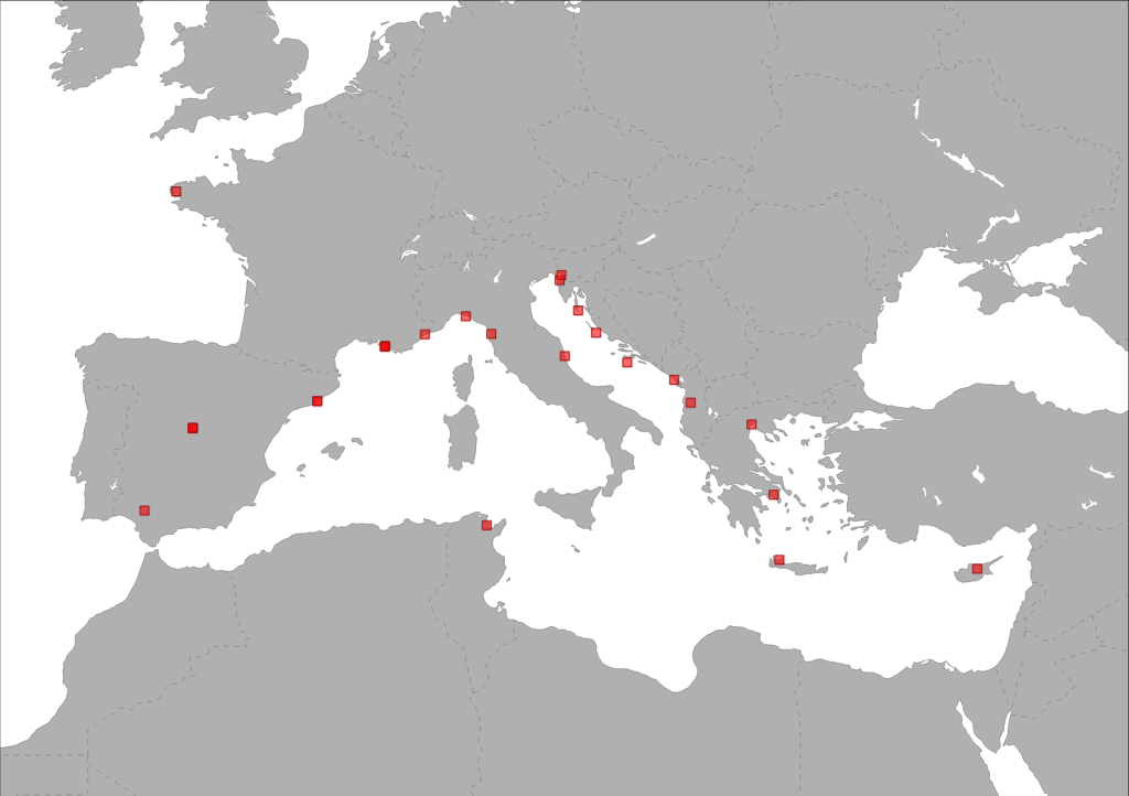
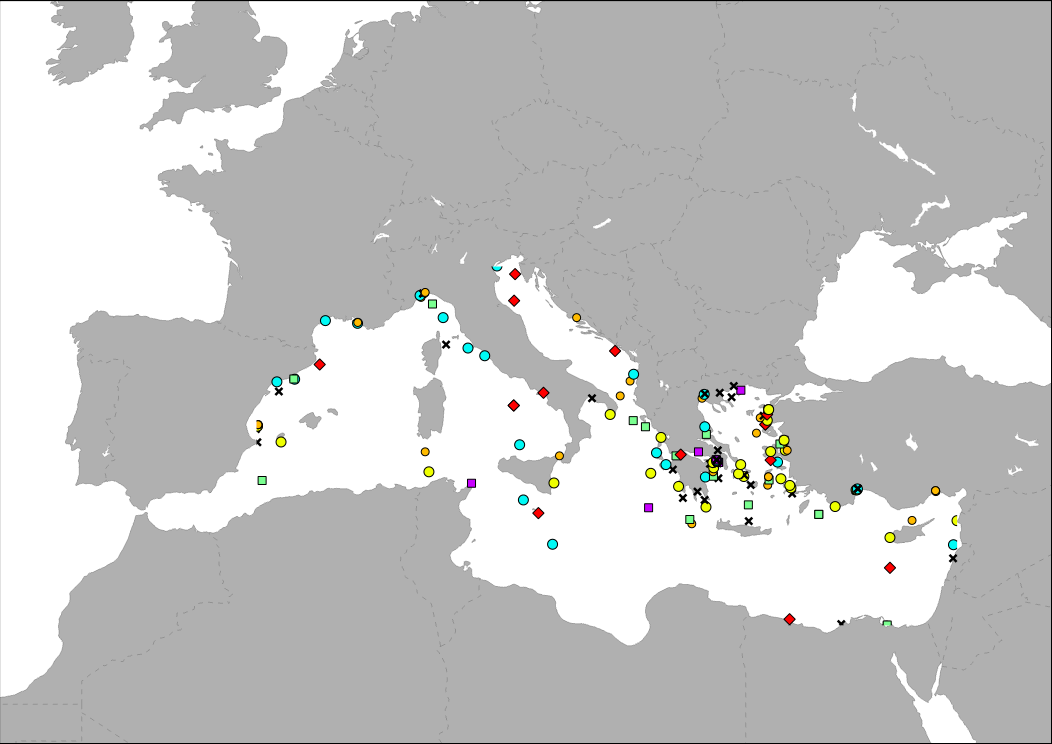
The layer shows type and location of partners involved in ACT4LITTER project. ACT4LITTER is a Study Project of the biodiversity protection community funded by the Interreg Med Programme. The ACT4LITTER project deals with “Joint measures to preserve natural ecosystems from marine litter in the Mediterranean protected areas”.
-
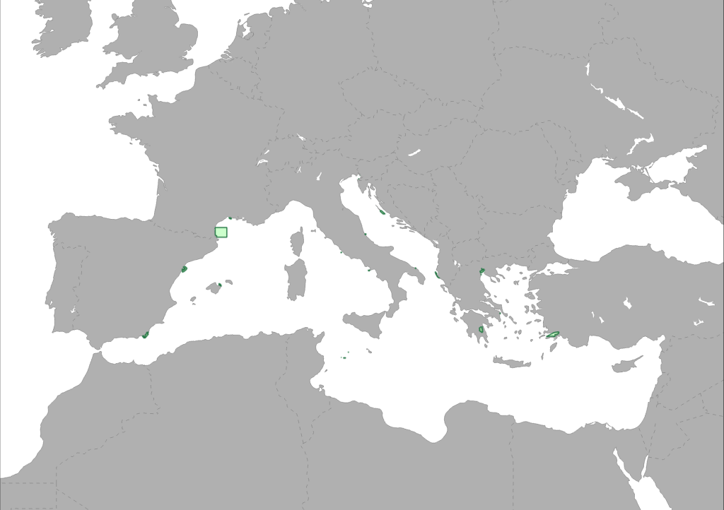
The layer shows type and location of pilot sites involved in ACT4LITTER project. ACT4LITTER is a Study Project of the biodiversity protection community funded by the Interreg Med Programme. The ACT4LITTER project deals with “Joint measures to preserve natural ecosystems from marine litter in the Mediterranean protected areas”.
-
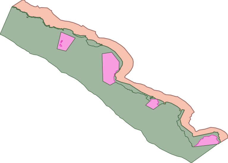
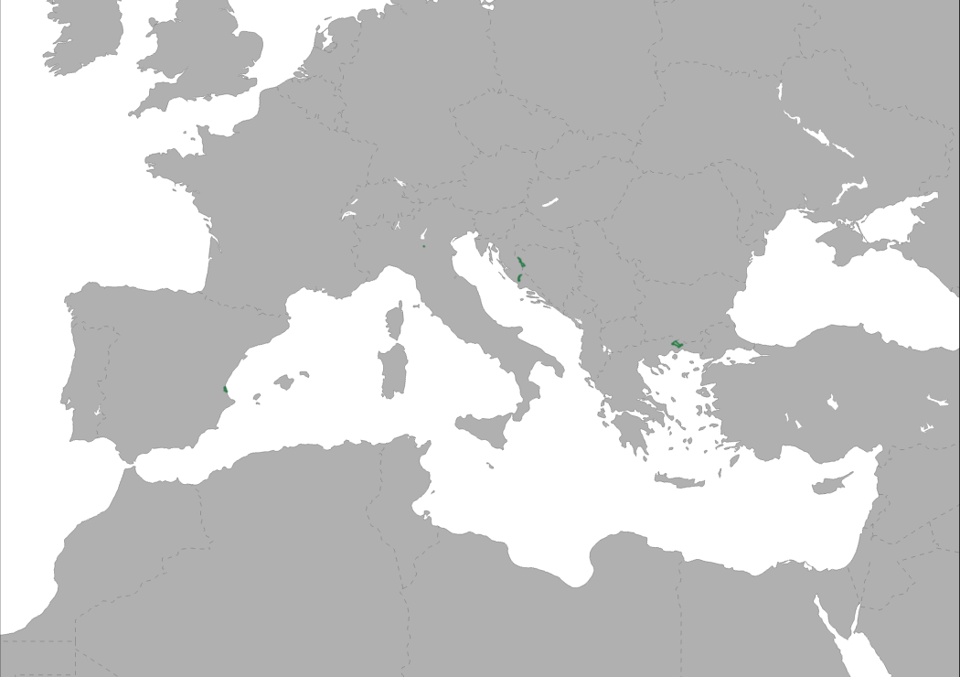
This dataset represents the coverate of the second Montenegro Marine Protected Area, the Nature Park "Katič" declared on the occasion of celebrating 30th anniversary of the adoption of the Declaration on the Ecological State of Montenegro. The "KaticThe Nature Park "Katič" covering 2744,93 hectares in both terrestrial and marine part, with 276.90 ha in the protection zone II, while 2468.29 ha in the protection zone III (out of which 2291.77 ha belong to the sea, and 176.52 ha to the land). A zone from the coastline of the MPA toward inland of 500m width defined as buffer but without any protection level.
-
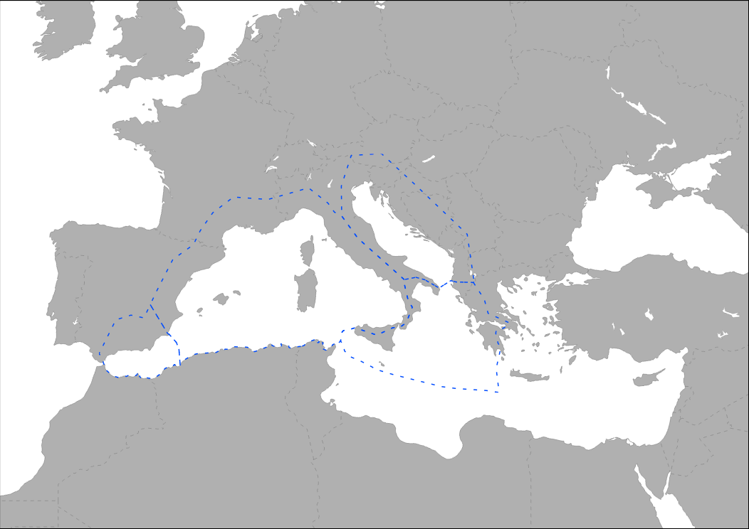
Med-IAMER project covers two main regions: the Western Mediterranean, including the Alboran Sea, as one study area and the Adriatic and Ionian Sea as the other study area. Both areas are represented by the boundaries defined by the Marine Ecoregions of the World (MEOW, Spalding et al. 2007). The ecoregion concept has been used for as these boundaries best represent the ecological differences in the Mediterranean.
-
The map shows the distribution of ship alerts and accidents along the Mediterranean Sea, between 2008 - 2014. This point layer represent the location of ship accidents registered in the database of the Mandate of the Regional Marine Pollution Emergency Response Centre for the Mediterranean Sea (REMPEC). Database includes accidents that caused pollution by oil or other hazardous and noxious substances (HNS), or were likely to cause it.
-

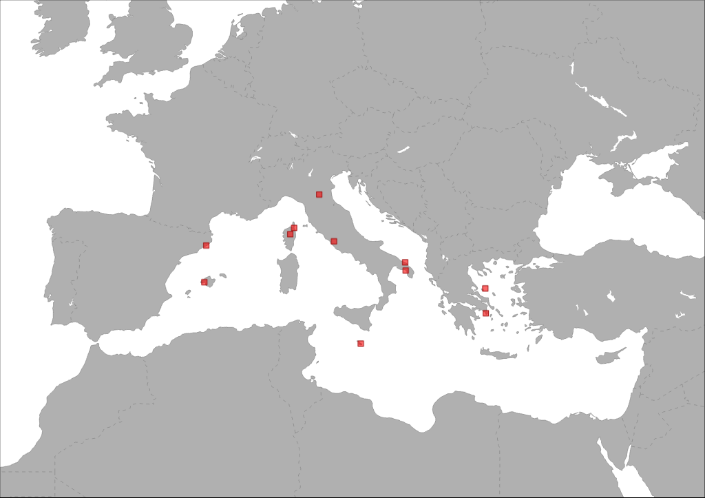
The map shows the distribution of main passengers transport ports in the Mediterranean Sea. Ports are classified in groups according to its level of activity.
-
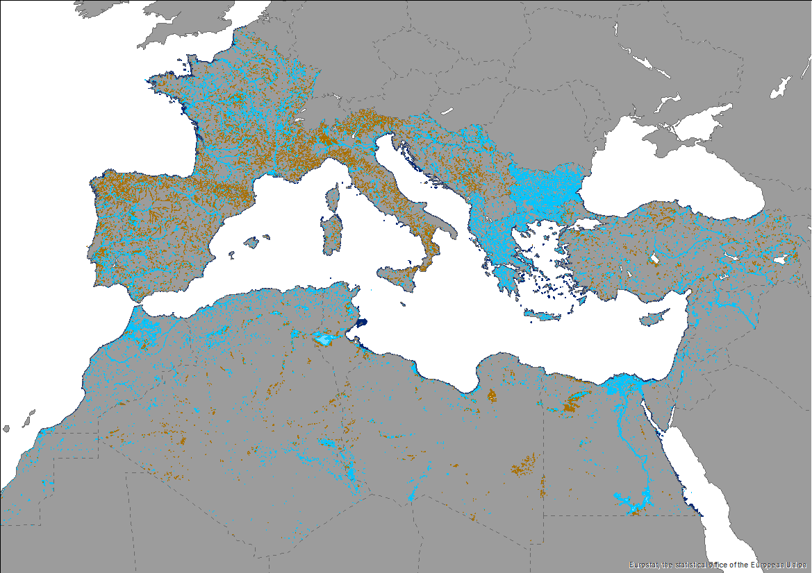
This knowledge base builds on methods and approaches developed in the framework of on-going efforts at the Mediterranean scale to map wetland ecosystems and assess their condition. It is relevant for several on-going initiatives at a regional, European and global level (e.g. UN Decade on Ecosystem restoration, EU Biodiversity Strategy for 2030, the Barcelona Convention and its protocols on Integrated Coastal Zone Management and Specially Protected Areas). The development of the products presented in this report was carried out through a collaborative process that aimed to engage key players and stakeholders working on different aspects and scales of wetland mapping and habitat identification in the Mediterranean region. The Pan-Mediterranean wetland knowledge base constitutes the first step in building and making available a harmonised knowledge base across the whole region on the spatial extent, distribution and type of wetlands in the Mediterranean region. Despite the amount of data ingested and the variety of contributors, large areas of the whole basin still lack detailed and reliable regional data, which makes the final Pan-Mediterranean wetlands map worth improving as data and knowledge becomes more available and accessible over time. Further efforts are needed to identify available higher resolution data for specific areas.
-
The layer shows type and location of pilot sites involved in EcoSustain project. EcosSustain is a Pilot Project of the biodiversity protection community funded by the Interreg Med Programme. The EcoSustain project deals with “Ecological sustainable Governance of Mediterranean protected areas via improved scientific, technical and managerial knowledge base”.
-
The layer shows type and location of partners involved in AMAre project. AMAre is a Study Project + Pilot Project of the biodiversity protection community funded by the Interreg Med Programme. The AMAre project deals with “Actions for marine protected areas”.
-
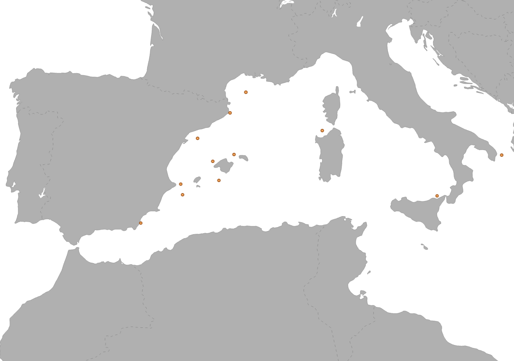
The Interreg Med CONFISH project aims to design a Mediterranean-based network that relies on robust social framework and cutting edge evolutionary science for future implementation of bottom up approach into fishery management. The overarching goal is to promote knowledge transfer between evolutionary scientists and local fishery stakeholders towards sustainable fisheries management Sample area on Aristeus antennatus specie.